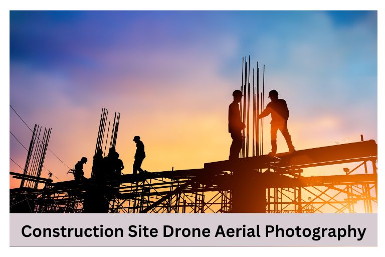
Drones are used to take pictures from above construction sites, providing a detailed view of the building’s progress. They are important tools for project managers, architects, and investors, offering new information that was previously unavailable. Drone aerial photography offers a unique perspective that allows us to appreciate the scale and complexity of construction projects like never before.
Construction Drone Photography
Construction drone photos give a unique view of construction sites from above, making it easier to analyze and monitor progress. Combining drone photography with monitoring tools helps construction companies manage projects better. Drones can navigate complex structures quickly and capture important insights that traditional methods may miss. High-resolution images from different angles help project managers make informed decisions based on actual on-site conditions.
Adding gas sniffers to drones enhances safety by detecting harmful gases or pollutants that could harm workers. Using construction drone photography is essential for modern construction practices that prioritize precision, efficiency, and safety compliance.
What Can Construction Site Drone Photography Do For You?
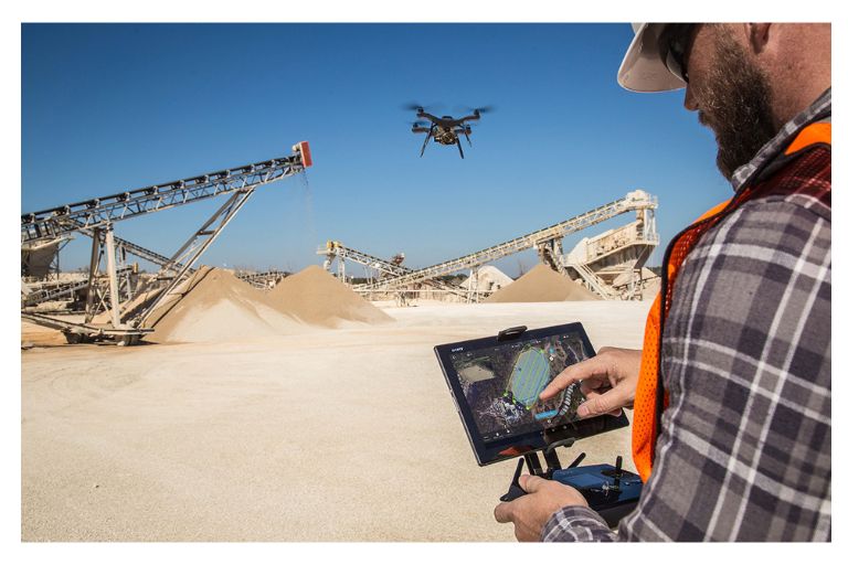
Drone photos from a construction site give you a special view to see how your project is going. You can use this technology to watch the site live, spot problems early, and make smart choices that save money and help manage the project well. By knowing the site layout and conditions from above, you can plan and do tasks better. Here are a few things we can do.
Construction Photography in the Pre-Construction Phase
Construction photography before the building starts gives a different view than regular surveys. Aerial photos show the construction site, helping managers see potential problems and plan better. Detailed drone images can make decision-making easier and prevent expensive mistakes.
Using drones for aerial photos before building begins can improve communication among different groups involved. Sharing clear visual data with architects, engineers, and clients ensures everyone understands the project. This clear communication makes work smoother and leads to successful projects with fewer mistakes or delays.
Accurate Data Capture
Using drones in construction projects changes how data is collected by providing very accurate and detailed information much faster than traditional methods. Drone photography’s precision is important for keeping construction projects on schedule and within budget.
Drones can capture millions of data points from above, giving project managers exact measurements for piles, areas, and volumes. Photogrammetry software like Pix4D or DroneDeploy improves the accuracy of drone data. Construction professionals can achieve precise accuracy consistent with global geodetic coordinates by adding Ground Control Points (GCP) and Real-Time Kinematic (RTK) capabilities to drone flights.
This precision helps with project planning and makes it easier to share location-based data across different platforms. Collecting precise data with drones changes how construction sites are monitored and managed, making operations more efficient and safe.
Stockpile Measurement
Drones with special software can make detailed 3D models of stockpiles, giving accurate volume measurements without manual work. This technology boosts efficiency, cuts costs, and improves safety by avoiding the risks of measuring on the ground.
Drone stockpile measurement lets businesses monitor changes and plan better for operations. Drones are more flexible and can reach tough or dangerous spots without risking workers, making them great for sites with hard terrain or conditions. This flexibility makes drone technology important for industries needing precise stockpile measurements for success.
During the Construction Phase
Drone surveys are changing how construction progress is monitored. Drones give detailed views that can catch problems early and avoid delays. This technology shows the whole site, making it easy to compare progress and communicate well.
Project managers can make smart decisions with real-time information using drone survey data in BIM or other platforms. Tracking progress precisely helps resolve disputes and improves project transparency. As the construction industry employs more drone surveys, we can expect better efficiency, accuracy, and teamwork in future projects.
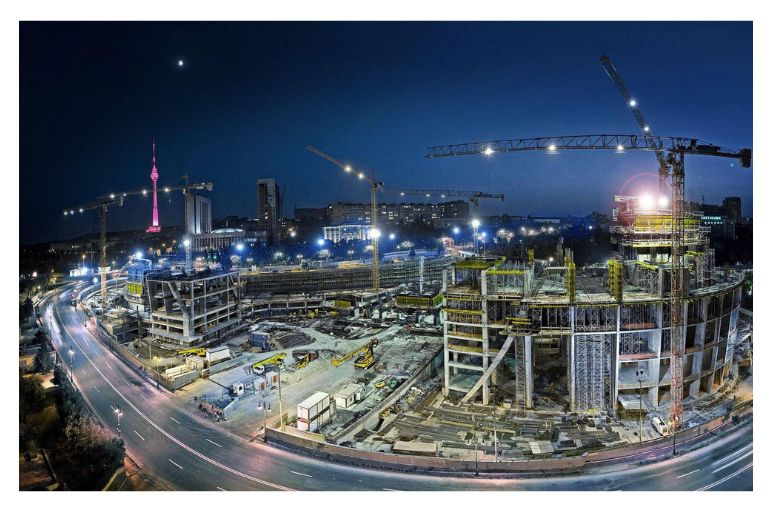
Construction Aerial Photography for Tracking Progress
By harnessing the power of construction aerial photography, tracking progress has never been more efficient and detailed. Capturing as-built footage at various build stages provides stakeholders a clear visual representation of the project’s development. This enhances communication and ensures everyone can easily grasp the current status and make informed decisions.
Drones and 360 visuals offer a level of accuracy and detail that traditional methods simply cannot match. From identifying potential issues early on to monitoring site safety and compliance, aerial photography provides valuable insights that can significantly impact project timelines and budgets. By embracing this technology, construction professionals can streamline processes, improve collaboration, and ultimately deliver better results for all parties involved in the project.
Conclusion
Drone aerial photography has transformed how we monitor construction sites. The detailed pictures help project managers and stakeholders make decisions and improve project efficiency. Drones can reach hard-to-reach spots and take detailed pictures from different angles. They will get better as technology improves. Using drones is crucial to stay competitive in construction. Start using drone photos now for a smoother construction process.
Frequently Asked Questions
What are the benefits of Using drone Aerial Photography for Real Estate listings?
Drone aerial photography real estate provides stunning, high-quality images that showcase the entire property and surrounding area from a unique perspective.
How can I locate Drone Aerial Photography near me?
You can use online directories, search engines, and social media platforms to find local drone photography providers.
Do drone Aerial Photography Prices include Editing Services?
Some packages may include basic editing services, while others may charge extra for more detailed post-production work.
Are there any legal Restrictions or Regulations regarding using Drones for Construction site Photography?
Yes, it is important to adhere to local regulations and obtain necessary permits before using drones for photography on construction sites.
How can drone Photography improve safety on Construction sites?
By conducting regular drone surveys, safety hazards can be identified early, ensuring a safer working environment for all personnel involved in the construction project.
Is it necessary to obtain Special permits or licenses to use drones for Photography on Construction sites?
Yes, it is important to comply with local regulations and obtain necessary permits before using drones for commercial purposes such as construction site photography.