
Drones have revolutionized the way we capture aerial data, offering a new perspective and endless possibilities for industries ranging from agriculture to construction. As the demand for drone mapping services continues to rise, many individuals find themselves pondering a crucial question: How much should I charge for drone mapping? Drone mapping prices is between $100 and $240 per hour, or $800 to $1,500 per day.
How much should I charge for drone mapping?
Drone mapping costs between $100 and $240 per hour, or $800 to $1,500 per day. The cost of drone mapping services can vary. Prices depend on your location, skills, clients, and other factors.
Factor You Need To Consider When Coming Up With A Price For Your Services
When determining the price for your services, it is crucial to consider some factors such as:
Training And Certification
Beyond just a Part 107 license, investing in additional skills like GIS, remote sensing, and map making can greatly enhance the value you offer to clients. Educating yourself on various mapping software also allows you to deliver more comprehensive and accurate results. The level of expertise gained through training and certification directly impacts the quality of service you provide.
Insurance
Many new drone operators forget about getting insurance for their drone business. It is important to have insurance because your equipment can be stolen or damaged while you’re using it. If you don’t have insurance, you’ll have to pay for repairs or replacements yourself.
Insurance is also important in case your drone crashes and causes damage or injuries. Drone insurance with $1 million coverage usually costs between $500 and $1,000. If you’re starting out and can’t afford an annual plan, you can get monthly coverage for $30 to $100 with the same protection level.
Deliverable
When deciding on your prices, think about how hard and skilled the work is. If a task needs special skills or extra work, charge more to make sure you’re paid fairly. Knowing the details and time needed for each task helps you see how valuable your work is. Also, talk to clients about what they want for each task, as customized work can affect pricing.
Equipment
The equipment you use can make a big difference in the value you offer your clients. For instance, getting top-notch mapping drones like the DJI Matrice series can boost the accuracy and abilities of your work. They can be costly, ranging from $10,000 to $100,000.
It is also important to think about extra accessories like RTKs, LiDAR systems, thermal cameras, and GPS devices to provide complete solutions to clients. These tools not only make your work more precise and efficient but also improve the quality of service you provide.
Marketing
Investing in marketing, like making sample projects and sharing them on YouTube, can show potential clients what you can do. Using SEO and targeted ads can help you reach your audience. To get a good return on investment, find out where your target clients are and focus your advertising there.
Business Expenses
When pricing your drone services, make sure to include all business expenses to cover costs and make a profit. Travel costs can increase rapidly for mobile businesses like drone services, so remember to include fuel, maintenance, and other related expenses. Also, think about the costs of renting equipment you don’t own and any salaries or allowances for staff if needed.
Software
When setting drone mapping services cost , it is important to think about the cost of software. Programs such as Pix4D and DroneDeploy are necessary for collecting data and making accurate maps and models. Their monthly fees can increase your overall expenses.
If you need special tools like an ArcGIS license for your projects, you’ll need to budget a lot for software costs. Choosing cheaper options like QGIS can reduce some expenses without losing any features.
Competition
It’s important to carefully assess your competition when setting prices for your drone services. While it may be tempting to undercut other businesses in order to attract more clients, charging too low can devalue the service for everyone in the industry.
By offering competitive rates that are around 15 percent below the market standard, you can establish yourself as a cost-effective option without compromising the overall value of drone services.
Drone Mapping Pricing
When setting prices for drone mapping services, consider both the costs of providing the service and the need for a reasonable profit. Aim for a profit margin of 5-20% to ensure fair compensation and competitiveness.
Once you decide on an amount, choose one of these pricing models:
Price Per Acre
The most common pricing models for agricultural mapping services is drone mapping price per acre. This approach works well for those offering mapping solutions to farmers or landowners who need detailed information on their fields. By charging a rate based on the size of the land being mapped, clients can easily understand and budget for the cost of the service.
Pricing Per Hour
Pricing per hour is a common pricing model in the mapping industry, as it provides flexibility and transparency to both the service provider and the client. By charging an hourly rate, clients can have a clear understanding of how their budget is being allocated and can track the progress of the project effectively.
This model also incentivizes efficiency and productivity on the part of the service provider, as they are motivated to complete tasks within a reasonable timeframe to maximize their earnings.
Pricing Per Day
Pricing per day offers a sense of predictability for both you and the client. By setting a fixed rate for each day of work, there are no surprises or fluctuations in costs, making budgeting easier for everyone involved.
This model also allows you to focus on completing the job efficiently without having to worry about tracking hours or constantly updating invoices.
Charging Per Project
Charging per project enables you to demonstrate the value of your work without getting bogged down in hourly rates and time-tracking. Clients appreciate knowing exactly what they are paying for and what results they can expect, fostering trust and transparency in your professional relationship.
By setting clear expectations and delivering on them consistently, you not only build credibility but also increase your chances of securing repeat business through referrals and recommendations.
Price Per Deliverable
When a client only needs one item, like a map or a 3D model, you should think about the software cost and the work required to set a price for that item.
How Much Are Drone Pilots Charging For Drone Mapping?
To determine your pricing, look at what your competitors are charging. Contact local companies to see what they offer and how much they charge. Some may have this information on their website, while others may not.
A survey by AirStoc and DroneDeploy found that drone pilots who offer mapping services can charge higher rates, especially if they have GIS certification and $1 million insurance coverage. This data is from 2017 to 2020, so you should do your own research to set the right prices.
More Tips For Charging For Your Drone Mapping Service
Other effective strategies for charging for your drone mapping service includes:
Analyze Your Profitability Every Month
By diligently checking your financial statements, you can gain valuable insights into the revenue generated, costs incurred, and overall financial health of your business. This practice allows you to identify any areas where you may be overspending or undercharging for your services.
Test Different Models
Testing different prices, packages, and options is important to figure out the best way to make money.
Conclusion
How much should I charge for drone mapping? To determine the best prices for drone mapping services, think about factors like business expenses, competition, and insurance. Research the market well and know the worth you provide to clients to set rates that are both competitive and profitable. Keep updating and modifying your prices to remain competitive and ensure your business is sustainable.
Frequently Asked Questions
How much does Drone Land Surveying Cost?
The cost of drone land surveying can vary depending on the size and complexity of the area being surveyed, typically ranging from $30 to $120 per acre.
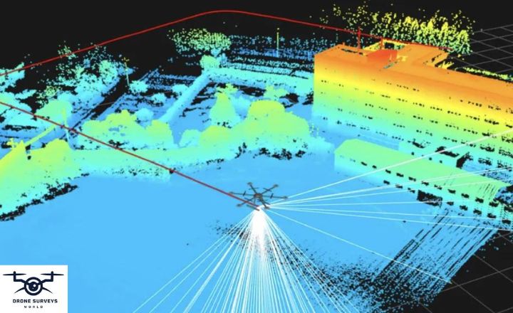
How much does a LiDAR Drone Survey Typically Cost?
The cost LiDAR drone survey cost can vary depending on factors such as the area to be surveyed and the level of detail required.
Are Drone Cartography Services Environmentally Friendly?
Using drones for cartography services can be more environmentally friendly compared to traditional aerial surveys as they produce fewer carbon emissions and have minimal impact on the environment.
How can we Calculate Aerial Survey Cost?
The cost of an aerial survey is typically calculated based on factors such as flight time, equipment needed, data processing requirements, and the size of the area to be surveyed.


